
Indian Boundary Bike Tours Poster
When we say that we are a nation of immigrants, it is true to an almost impossible degree. Barely 2% of the US population identifies as Native American. Similarly, what once was all land occupied by the indigenous people the Europeans encountered and overtook, presently only about 2% of all lands in the US are held in Indian Trust Land accounts. Our local history is not exceptional to this and our geography, culture, cities, streets and neighborhoods bear the intrinsic mark of the indigenous people of this land.
The Treaty of St. Louis is a name given to a series of treaties between the United States and a number of Native American tribes and Nations between 1804 and 1824. These treaties dramatically reshaped the boundaries of what are now the Midwest States and served as the beginning of a new US policy of acquiring the land of indigenous Nations and displacing their people. These treaties and newer policy were a continuation of a less official policy of land grabbing and indigenous people displacement that began with the arrival of the first Europeans and continued with the formation of the American Colonies and the establishment of the United States. The Treaty of St. Louis would serve as a precursor for Andrew Jackson’s administration, which no longer placed any importance in negotiating with separate Nations and subsequently adopted a hardline policy leading to the Indian Removal Act, and the forced displacement of all indigenous people east of the Mississippi River and the establishment of the doctrine of eminent domain.
Prior to the Treaty of St. Louis, the bulk of what became Illinois was also acquired by agreement with the indigenous Tribes, and some boundaries were set in the first Treaty of St. Louis with the Sac and Fox nations. These areas would later be reclaimed by the US, in the second treaty. The second Treaty of St. Louis was signed just south of St. Louis Missouri in Portage des Sioux, Missouri on August 24, 1816, 200 years ago. This treaty was signed between the United States and the Council of the Three Fires, which included the Ottawa, Ojbwa and Potawatomi Nations. This treaty gave $1,000 annually from the US to the three tribes for the ceding of a giant swath of land that today defines the Chicagoland region. This was a direct response to the Battle of Fort Dearborn in 1812, which was won by the indigenous tribes but ultimately led to a series of Treaties and US policy that removed them from their lands in the Great Lakes region. The resulting 1816 treaty created a 20 mile strip between Lake Michigan and the Fox River on the north, which met the Illinois River on the south. The acquisition of this land was deemed necessary for population expansion, trade and business opportunities and infrastructure development. It also enabled the creation of the Illinois and Michigan Canal originally envisioned by Father Jacques Marquette nearly two hundred years prior. The canal even preceded Illinois’ statehood and enabled its acceptance as a state in the Union without qualifying based on population.
All of this was the result of the second treaty. The northern Indian Boundary was further codified in the Treaty of Chicago of 1821 and the second Treaty of Chicago in 1833, again between the US Government and the Council of the Three Fires. The legacy of these treaties and the displacement of the indigenous people of the area result in the geography of Chicago and its suburbs. The northern Indian Boundary travels along the northern Community Areas of Chicago and the immediate northern suburbs stretching from Lake Michigan to the Fox River. Many of the curious street patterns, diagonal orientation of streets, neighborhood, school and street names are vestiges of the Nations that were displaced to form them.
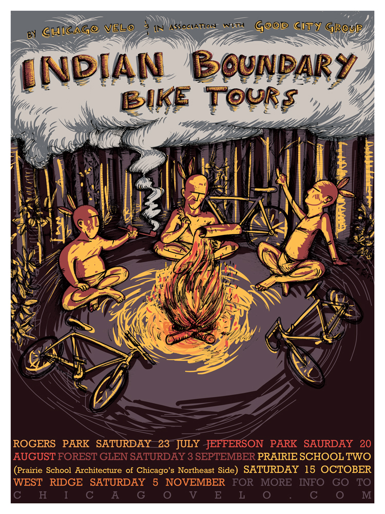
To explore these areas, the history of their formation, and the story of the people that were here before us all, Chicago Velo is organizing the Indian Boundary Bike Tours in conjunction with Good City Group. These tours will look at 4 different Chicago Community Areas along the northern Indian Boundary line, namely Rogers Park, Jefferson Park, Forest Glen and West Ridge. We will also incorporate our second Prairie Architecture tour of Chicago, exploring Prairie Architecture of Chicago’s northeast side, including Uptown, Edgewater, Rogers Park and West Ridge. This tour is brand new and is called Prairie Tour Two.
We are partnered on this series with a non-profit group called Good City Group which is comprised of architects, designers, engineers and planners seeking to create methods of achieving healthier, sustainable cities. This series augments the timing of their work on their Last Mile project, which focuses on transportation and commuting options after a commuter departs a train or bus station, and is centered in Jefferson Park, where my company Big Shoulders Realty has been for the past decade.
And of course, both the tour series and Prairie Tour Two are represented with brand new posters by our regular artist and friend Ross Felten.
I also want to point out I am aware of the odd looking calendar listings on your right and we are hoping to have that fixed shortly, but despite the flipped out look, all the links seem to work and you can still register for a tour. We’ll kick things off this weekend with the Tour of Rogers Park.
I look forward to seeing some of you there.